How to Identify Block Numbers In Google Maps
Example: 6
th
Street from Congress Avenue to Guadalupe Street
1. Go to web address www.google.com/maps
2. Type the intersection into search box & Search
Note: A map will load and a bubble will indicate the intersection at this time.
3. Zoom into the intersection as close as you can (without going into street view). You will see
tiny font populate, almost transparent on the streets that you may have never noticed before!
These are block number indicators! Now you know that 6
th
Street at Congress is the 100
Block of 6
th
.

4. You will now pan the map towards Guadalupe Street.
Note: If you aren’t sure which direction Guadalupe is in, you can zoom out until you find
it. You could also just start the process over and search 6
th
Street at Guadalupe.
Note: To Pan the map, click the map, hold the button and move the mouse in any direction.
The map will move with the mouse.
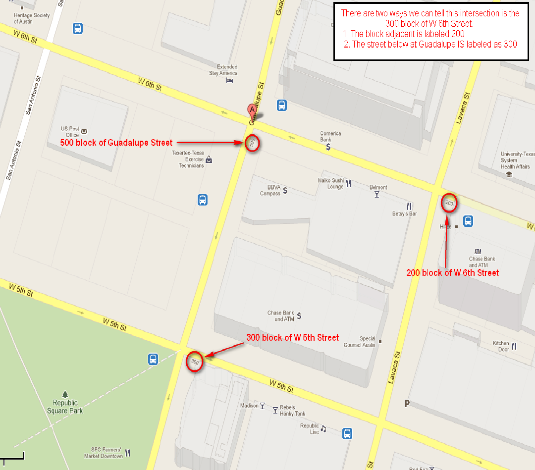
5. Zoom in on your next intersection. Below is 6
th
Street at Guadalupe. In this example, the block
number for this segment of 6
th
is not populated. This is something that occurs often in Google
maps. It is the 300 block of W 6
th
Street. See map below for the easiest way of determining the
block number when it does not auto populate.
After using Google Maps, you now know that 6
th
Street between Congress and Guadalupe
is actually the 100-300 blocks of W 6
th
Street!
